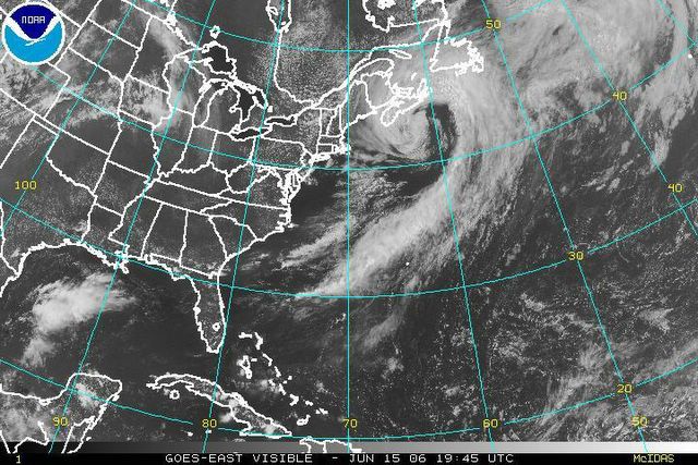
Visible satellite image of Eastern North America, showing the composite low centered South of Nova Scotia. Note the tightly coiled coma shape, indicative of intense mid-latitude systems. Luckily for residents of Nova Scotia the heaviest rains and severest gales, as well as the area of hurricane force winds, remained offshore.

posted by Advackia at 7:30 PM
![]()
![]()

0 Comments:
Post a Comment
<< Home