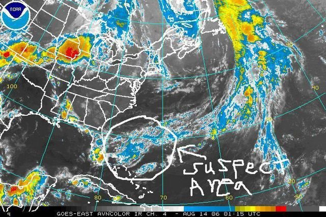
Color Enhanced IR Satellite Image taken yesterday evening. It shows an area of low pressure that has formed along a old frontal boundary East of Florida. This system as the potential to acquire tropical characteristics, as it remains nearly stationary over the course of the next few days. It may also play some role in our weather later this weekend, or early next week. Stay tuned.

posted by Advackia at 7:20 AM
![]()
![]()

0 Comments:
Post a Comment
<< Home